Get Property Line Surveying in Asheville, NC
Property line surveying services help Asheville property owners define boundaries, resolve disputes, and support projects like fencing, additions, or land development.
Property line surveying services provide property owners with precise boundary measurements, helping to clearly define the limits of their land. In Asheville, NC, where property boundaries can impact construction, landscaping, or fencing projects, accurate surveys ensure that improvements are within legal boundaries, reducing the risk of disputes with neighbors. These surveys also support property development by confirming exact property lines, which can enhance the overall functionality and usability of outdoor spaces.
Beyond legal clarity, property line surveys contribute to the long-term durability and curb appeal of a property. Properly marked boundaries can prevent encroachments and reduce maintenance issues caused by unintentional overgrowth or construction. Additionally, well-defined property lines can improve the visual appeal of a landscape, making the property more attractive and increasing its value. Engaging experienced local professionals ensures that surveys are accurate and reliable, providing peace of mind for property owners in Asheville.
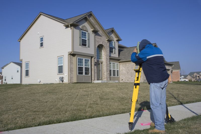
- Residential Property Line Surveys - needed when establishing property boundaries for new construction or additions in Asheville, NC and surrounding areas.
- Boundary Dispute Resolution - utilized to clarify property lines during conflicts or legal disputes between neighbors in nearby communities.
- Subdivision Planning - required for dividing larger parcels into smaller lots for development or sale in Asheville and neighboring regions.
- Fence and Landscaping Projects - necessary to accurately mark property limits before installing fences, hedges, or other landscape features.
- Commercial Property Surveys - conducted to define boundaries for business sites, parking lots, or industrial developments in Asheville and nearby locales.


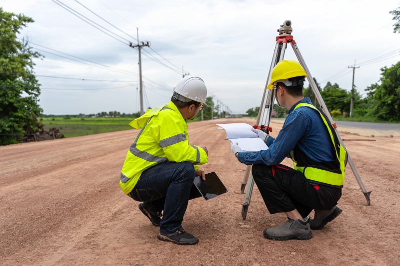
Property line surveying services involve the precise measurement and mapping of a property's boundaries. These surveys typically include establishing property corners, identifying existing boundary markers, and creating detailed maps that delineate the exact limits of a parcel. Such surveys are essential for ensuring that property lines are accurately defined, especially when boundaries are unclear or disputed. Professional surveyors utilize specialized equipment and techniques to provide clear, reliable boundary information that can be used for legal, development, or personal purposes.
These services help address common property-related problems such as boundary disputes, encroachments, or uncertainty about property limits. When property owners plan to build new structures, add fences, or subdivide land, a property line survey provides the clarity needed to avoid conflicts with neighbors or potential legal issues. Accurate boundary data can also support resolving boundary disagreements by providing definitive evidence of property limits. Additionally, property line surveys are often required during real estate transactions to verify parcel boundaries before closing.
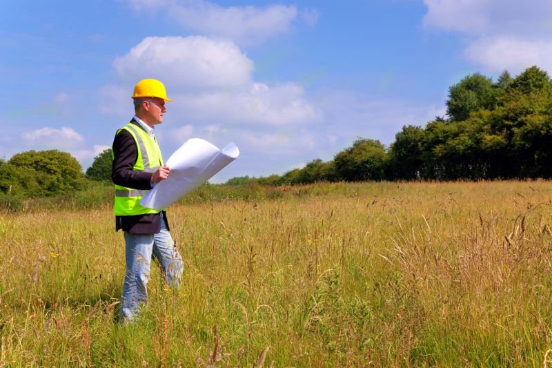
Various types of properties typically utilize property line surveying services. Residential properties, including single-family homes and large estates, frequently require boundary surveys for fence installation, renovations, or boundary disputes. Commercial properties, such as retail centers, office buildings, and industrial sites, often need precise boundary information for development or leasing purposes. Agricultural parcels and vacant land are also common candidates for boundary surveys, especially when planning for future use or subdivision. Regardless of property size or type, accurate boundary delineation is vital for maintaining clear property rights.
Engaging property line surveying services can help property owners and developers avoid future complications related to boundary issues. By obtaining a detailed and accurate survey, individuals can make informed decisions about their land, plan construction projects responsibly, and ensure compliance with local regulations. Connecting with experienced local surveyors provides access to the expertise needed to establish or confirm property boundaries, helping to protect property rights and facilitate smooth property transactions.
The overview below groups typical Property Line Surveying projects into broad ranges so you can see how smaller, mid-sized, and larger jobs often compare in Asheville, NC.
In many markets, a large share of routine jobs stays in the lower and middle ranges, while only a smaller percentage of projects moves into the highest bands when the work is more complex or site conditions are harder than average.
Basic Property Line Survey - Typically costs between $300 and $800 for straightforward boundary identification on small to medium-sized lots. Prices vary based on property size and terrain complexity.
Residential Property Survey - Usually ranges from $500 to $1,500, covering detailed boundary lines and easements for residential properties in Asheville and nearby areas. Larger or more complex sites may cost more.
Boundary Line Adjustment - Costs generally fall between $1,000 and $3,000 depending on the scope of the boundary change and property size. Additional costs may apply for legal filings or permits.
Subdivision Property Survey - Typically starts at around $2,000 and can go over $5,000, especially for large subdivisions or developments requiring multiple lot boundaries and detailed mapping. Prices depend on project complexity.
Actual totals will depend on details like access to the work area, the scope of the project, and the materials selected, so use these as general starting points rather than exact figures.
Boundary Line Surveys - These surveys help determine property boundaries accurately, assisting property owners in avoiding disputes with neighbors.
Fence Line Surveys - Professionals can identify precise property lines to ensure fences are installed within legal boundaries and prevent encroachments.
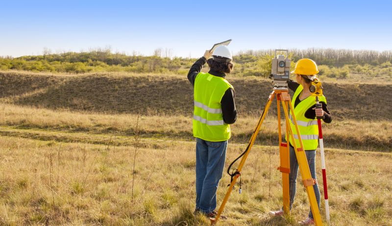
Subdivision Surveys - Subdivision surveyors assist in dividing larger parcels of land into smaller lots, supporting development and sale processes.
Elevation and Topographic Surveys - These surveys provide detailed elevation data to support construction planning and site development near property lines.
As-built Surveys - As-built surveys document existing property boundaries and structures, useful for verifying that previous work complies with property lines.
Legal Description Surveys - These surveys prepare detailed legal descriptions of property boundaries, essential for deeds, titles, and land transactions.
Property line surveying requires experienced professionals who understand local property boundaries and regulations. When comparing options, consider the background and expertise of the surveyors to ensure they are knowledgeable about the specific requirements in Asheville, NC and surrounding areas. Reputable surveyors often have a history of completed projects in the region, demonstrating familiarity with local property layouts and boundary challenges. This experience can contribute to more accurate and reliable survey results, helping homeowners avoid future disputes or encroachments.
Clear, written expectations are essential when working with property line surveyors. Reputable service providers typically offer detailed documentation outlining the scope of work, deliverables, and any necessary follow-up steps. Having these expectations in writing helps ensure that homeowners understand what will be provided and can compare services effectively. It also provides a reference point should any questions or concerns arise during or after the surveying process, fostering transparency and clarity.
Communication plays a key role in selecting a property line surveyor. Reliable professionals maintain open and prompt communication channels, making it easier for homeowners to ask questions, clarify details, and receive updates throughout the project. Reputable local pros often have positive references from previous clients, which can serve as indicators of their responsiveness and professionalism. By considering these factors-experience, written expectations, references, and communication-homeowners can better evaluate and choose survey providers that meet their specific needs.
Property owners in Asheville, NC use Property Line Surveying services for practical projects around their homes and businesses. The sections below highlight everyday jobs and straightforward project options.
Property owners in Asheville, NC, often seek property line surveying services when planning home additions, fencing projects, or landscaping efforts. Knowing the precise boundaries of a property helps prevent disputes with neighbors and ensures that improvements stay within legal limits. Whether establishing new property lines or confirming existing ones, local surveyors provide the clarity needed for these everyday projects.
Additionally, property line surveys are useful when purchasing or selling land, as they help verify boundaries and identify any potential encroachments. They are also valuable for resolving boundary disagreements or for understanding the exact extent of a property before making improvements. Connecting with experienced surveyors in Asheville can provide property owners with the accurate information necessary for a variety of common property-related needs.
What is a property line survey? A property line survey is a process that determines the precise boundaries of a property, often involving measurements and mapping to identify corners and lines.
Why might I need a property line survey? A survey can be useful for resolving boundary disputes, planning construction, or confirming property limits before buying or selling.
How long does a property line survey typically take? The duration varies depending on property size and complexity, but most surveys can be completed within a few days to a week.
What should I do to prepare for a survey? Ensure access to the property, clear any obstructions near boundary lines, and provide any existing property documents to the surveyor.
How can I find local property line survey providers? Contact local land surveying companies or service providers specializing in boundary mapping and property surveys in Asheville, NC and nearby areas.
Boundary Line Determination - Professionals can accurately identify property boundaries to prevent disputes and ensure compliance with local regulations.
Land Surveying for Property Development - Experts provide detailed surveys to support construction planning, lot division, and land development projects.
Fence and Structure Placement - Surveyors assist with marking precise locations for fences, sheds, and other structures to adhere to property lines.
Property Line Dispute Resolution - Local pros can help clarify boundary issues and provide documentation to resolve conflicts with neighbors.
Considering Property Line Surveying for a property in Asheville, NC? The sections above highlight common project types, practical options, and details that often shape the scope of work.
When you are ready, use the quote form to share a few details about your project. Local pros can review the basics and respond with options that match what you have in mind.